Dirty Harry's Peak 5.9.15
I planned to spend the day playing in the mountains and the weather actually cooperated. Aaron got in late Friday night from a business trip so we were trying to figure out what to do. He suggested the Tooth for a fun, mini alpine adventure. I was a little worried about how busy it might be on a nice Saturday. He said he’d be willing to go hike with me so then I tried to think of hikes I wanted to do but unfortunately a lot of them were in the North Cascades and I didn’t feel like waking up super early, so we finally decided on something down I-90. There’s not much down there that Aaron would actually like to hike so we finally settled on a new peak for both of us, Dirty Harry’s Peak. I had done the hike up to the balcony with Sara in February but wasn’t feeling 100% that day so we just made it a light hike in the morning and came home. I had planned to do it last weekend but ultimately decided to stay home and study so that I could go play in the mountains with Aaron this weekend. We set the alarm for 7am, actually rolled out of bed about 7:35am, packed and hit the road by 8:05am. We made a quick breakfast stop on the way and arrived to a fairly full trailhead near the entrance to the fire academy at exit 38 just after 9am. There were maybe a couple spots left when we got there. We saw a lot of people with rock gear heading up.
We grabbed our small packs, Aaron decided to just go with his running vest, and we started the road walk to the trailhead. There were a couple of groups already heading back to the cars, I’m guessing from hiking to the balcony. I was feeling better than my last time there so that was a good start. We met maybe one more pair on the way up to the turnoff for the balcony so it wasn’t too busy.

[Left] Crossing the bridge. [Right] Taking a break at the fork to the balcony
We stopped at the big cairn so I could shed my long sleeves and lower pant legs, and put sunscreen on. It was warm out for being early May, the high in Seattle was suppose to be 77 degrees. There was a pair of girls that had come from the balcony and started up the trail when we stopped, so we knew there’d be at least one more pair at the top. We started up the trail, following it through the trees. Not too long after the balcony trail there is was a little break in the trees so we could get a good view of McClellan Butte across I-90 from us. That was probably one of our best views of the day as we spent almost the whole hike in the trees.
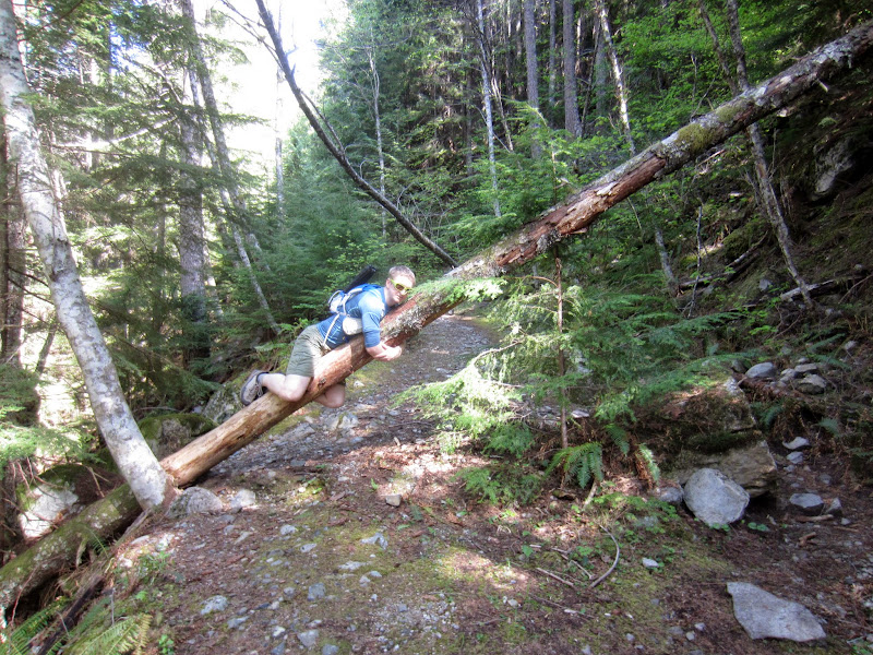
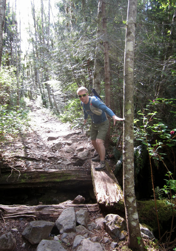
Treacherous log crossings on the trail, Aaron handled it with ease and style

One of the best views of the day, peek at McClellan Butte across I-90 from us as we head up
The trail was not my favorite, it was really rocky and there were several sections that were streams. The trail above the balcony receives a lot less traffic so the rocks were loose and made the going a little more treacherous, especially for someone who trips walking across flat floors. I had read about a ‘museum’ the week prior that had some old logging equipment left by Harry. We sort of decided last minute to do the hike so I didn’t look over information again, but I thought it was about 0.5 or 0.6 miles after the balcony trail, and was marked with a cairn on the right side of the trail. Just before the big stream that crosses the trail, Aaron spotted a cairn marking a hint of a trail disappearing into the trees, with some old cable next to it as well. We decided to explore on our way down which I think ultimately was a good choice.

Side trail we took to get to the 'museum'
Not long after that we hit our first big switchback and soon the steep really started to kick in. From my reading the week before, I knew at some point we’d need to take a left at a fork and go up what seemed like a creek bed even though the trail appeared to head a different way, so we looked for that. Really the trail was very straightforward to follow. At one point we took a left uphill as the old road straight ahead was covered in sticks, and just a little ways past this we saw the big talus field. Here was the left turn up the creek bed I had read about, marked with a cairn. It certainly feels like you’re hiking up a little stream, but there were other similar sections too. There are several little cairns after this to reassure you that you are on the right trail. The trail was certainly getting steep and I was getting tired so we took one last bigger break so I could eat some food. I mostly thought I was really out of shape (which I sort of am), not realizing just how steep it was until we had to come down the trail.
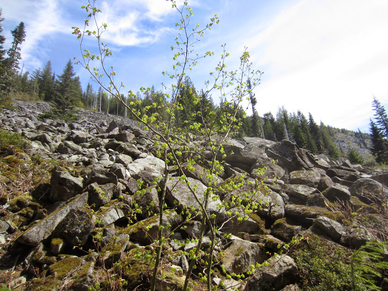

[Left] Talus field we saw when we took a left up the creek-like trail. [Right] Creek-like trail
I referenced the topo on my GPS a few times to make sure we stayed on the trail so I counted down the switchbacks we had left. We reached the ridge and the homestretch, although it was a push for me still. As we approached the summit we spotted a few snow patches still trying to linger in the trees, but well off trail. We finally reached the summit and joined the other hiking pair in enjoying the limited views there were. The summit is covered in trees with a little window on the north side so we didn’t see anything to the south, except for Mount Rainier through the trees. To the north we could see a very distant and hazy Mount Baker, and Glacier Peak seemed to be hidden behind another closer peak. Across from us is Revolution Peak with what looked like some sort of small building or hut on the mountainside. I had never noticed that before and was curious what it was. Back at home a Google search revealed it’s someone’s cabin. We grabbed some more food, chatted with the other hikers, and eventually started back down.

Revolution Peak dominates the summit view with it's visible alpine cabin below the summit. We could also see Mount Baker, Glacier was hidden behind another peak.
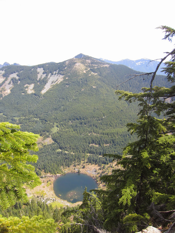

[Left] Revolution Peak with one of the Granite Lakes below. [Right] Summit shot, Aaron hiked another peak with me!
We met another hiker on her way up just minutes below the summit, otherwise we didn’t see another group until we were almost back at the trail to the balcony. On the way down we found the overgrown trail marked with a cairn and found our way through the trees to a more well worn trail that snaked its way up the mountainside, with cairns along the way to reassure us that we hadn’t missed the museum. We finally spotted the large, rusty truck with a mound of old cable. We checked it out, Aaron carefully balancing on the boards of the old truck bed. It was sort of interesting to see the old logging truck, and a fun little side adventure to go find something.


The museum of old logging equipment left on the mountainside
After another short break – I figured I would need one for me knees – we continued down. I figured we might as well see everything so that Aaron could experience all there was to on Dirty Harry’s Peak, so we ran out to the balcony quick. After about 30 seconds, just long enough for me to take a few pictures, we continued back down to the car.

View from the balcony
We passed a few more groups on their way up to the balcony before finally emerging from the trail back onto the road. There were several people along the river as we walked back across the bridge. The parking lot was overflowing and the road back towards the interstate was lined with cars – I’m guessing a majority of those were rock climbing because the trail really wasn’t that busy, at least compared to a lot of the other nearby hikes along the I-90 corridor. Overall it was a nice day and it was nice to get out in the mountains. The hike to the summit isn’t that great as you’re in the trees the entire time hiking up a pretty rocky trail that gets very wet, and the views from the top aren’t that rewarding. However, if you’re looking for some good exercise with easy access but not too crowded, then this is the place for you. On the other hand, I think the hike up to the balcony offers a great alternative to say Rattlesnake Ledge or Little Si and I’d definitely consider heading back there if I wanted a shorter, quick hike.
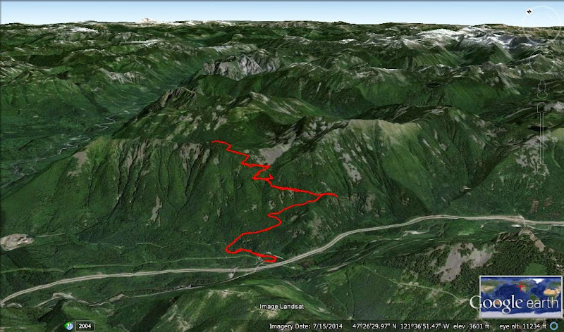
Our trail up Dirty Harry's Peak, GPS track here

Bottom portion of the trail, the upper extra bit is our side trip to the Museum

Upper half of the trail with our side trip out to the balcony, our adventure up to the Museum, and the final steep switchbacks to the summit