McClellan Butte 3.7.15
We had another sunny summer, er I mean winter, day forecast for Saturday so Aaron and I decided to head up McClellan Butte, a peak that's been on our to-do list for some time. Generally there's high avy danger in the winter so we haven't considered doing it then, but this year with the low snowpack several people had been up hiking. From the trip reports there were some patches of snow along the trail and people were using microspilkes, so we brought ours along with trekking poles. We left Seattle by 7:15am and after a breakfast stop, arrived at the trailhead as several groups were just starting up the trail.

Old water tunnel under where the train tracks would have gone
The first half of the trail meanders without gaining much elevation, crossing several roads. On the way down the highest road had several cars parked along it, I'm assuming folks who wanted to skip the first section. I walked down the slope by the large pipe under the trail to check out the waterfall and very blue water. As we broke out onto the talus field we got our first views of the I-90 mountains and found our first hiker. We stayed behind her until near the very top where our microspikes gave us an advantage on the compacted snow. The trail from here got serious, as in steep.

First good view down I-90 of the surrounding mountains, before we started the steep
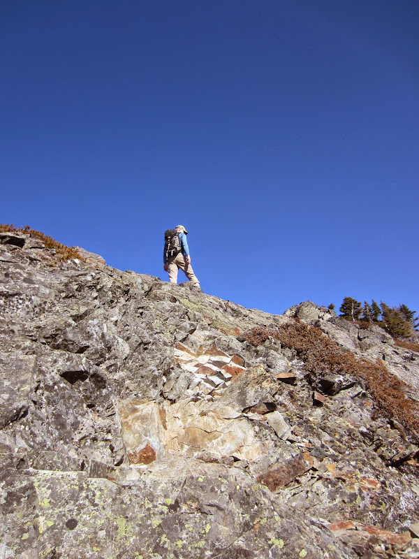
I slowly chugged uphill as we finally left the small switchbacks and started the larger traverse along the east side of the mountain. We didn't hit our first patch of snow until after the first avy chute. The patches were pretty small, although hard and slick as it was still somewhat early in the morning. These patches made the going a bit slower but we didn't feel like grabbing our microspikes just yet. After finishing the long traverse, heading around the south side, and turning north along the west side, we hit solid snow on the last stretch.

Snow on the final traverse to the summit
It was completely shaded on this side of the mountain and thus very slick. With very slight downhill sections along the trail though, I was going super slow as to not slip and fall. Finally I had enough and we pulled out the microspikes - my speed increased dramatically. We made good time along the rest of the trail up to the top. When we hit the last summit ridge, we stashed our microspikes and then started the scramble across to the true summit. The scramble was fun, not very challenging as it has a lot of good ledges but it is exposed. We joined several people already on the summit as we ate our snacks and took in the gorgeous views. It was a great day to be out in the mountains!

Final scramble to the summit. It's not as steep as it looks, lots of good steps to get across
Aaron's not one to hang out on the summit for very long so after we had gotten enough to eat and I took all of the pictures that I wanted, we headed back down. We were trying to make it down the scramble before the next large group started up.


Our summit shots

Panorama from the top of McClellan Butte, starting on the left looking west and circling around until facing east

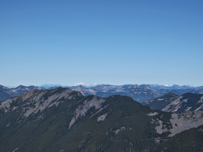
[Left] Snowy mountains in the distance, spotted Mount Stuart. [Right] Mount Baker in the distance
We grabbed our microspikes and put them on. Once past the big snow section, we decided to keep them on until we had passed the rest of the small snow patches. With how slick they were on the way up, I knew microspikes would make me more comfortable and a lot faster on the way down. The snow was definitely starting to soften on our way down as the temperature rose and the snow had been in the sun longer. There were lots of people heading up as we tried to quickly make our way down the steep portion of the trail. We took a couple of breaks so that I could sit and let me knees recover a bit. We made it back to the car about 2pm and sstopped for burritos on the way home. A great day in the mountains and I got to check another peak off of my list!

GPS track can be found here

Trail up McClellan Butte, fairly flat with lots of distance for the first 2.5 miles or so, then it gets steep