Alta Mountain 11.8.14
I wanted to take advantage of the rare, nice November day and get out in the mountains for a hike somewhere. The forecast was for sunshine and a high near 50 degrees in the Snoqualmie Pass area. I figured a shorter drive for a hike would be nice, especially since daylight is so limited. I got on WTA to search for something that I hadn't done yet and found Alta Mountain, 12 miles and 3300 feet of elevation gain with some views - sounded like a good option to me. I tried to find recent trip reports as the description for Alta mentioned several times (at least on Summitpost) not to do it if there was snow. It sounded like there was a bit of exposure that would be more difficult/sketchy to navigate with snow. I found some recent trip reports for Silver Peak, McClellan Butte, and Kendall Katwalk that indicated they were mostly snow free, but they are a bit short of Alta and from a week earlier. We had gotten a lot of rain since the reports so we weren't quite sure what to expect. We left Seattle just after 7am and encountered fog around North Bend. Luckily it cleared up as we hit Snoqualmie Pass and looking at Snoqualmie Mountain, it looked snow free - good sign! Sara drove and thus had the challenging task of navigating a very pot hole ridden forest service road to the trailhead. There was just no avoiding many of them so the last 4 miles was fairly slow going. I was surprised to find a few cars at the trailhead for Rachel Lake we when arrived, and a couple more pulled in as we got ready.
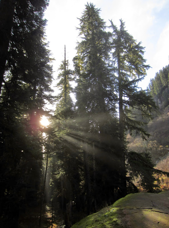
Sun breaking through the trees on the trail in to Rachel Lake
We left the trailhead about 9am and immediately got a preview of what the trail to Rachel Lake would hold for us, as we crossed through a giant mud puddle to start on the trail. I had hiked to Rachel Lake in early October back in 2009. I had the trail to myself and remembered frost covering the meadows, and of course beautiful Rachel Lake, but I blocked out most of the hike in. After the initial mud puddle, the first stream crossing was also more challenging. The water levels were pretty high so I splashed across on some rocks, and then had to navigate my way over a couple of large, fallen trees. Did I mentioned everything was a bit wet? The trail more often than not seemed to be a running stream or large mud puddles. We were able to get across without too much issue but it slowed things down a bit. We stopped several times to snap pictures of the little waterfalls along the trail.


[Left] Matt and Sara in front of the biggest waterfall we passed on the way to Rachel Lake. [Right] Hibox Mountain
I was feeling pretty good until we hit the 1200' gain over a mile that would take us to Rachel Lake - probably because we hadn't been working too hard yet. I was trying to eat as much food as I could because I could tell I was low on energy. We finally emerged at Rachel Lake and found some sunny rocks to take a break on.
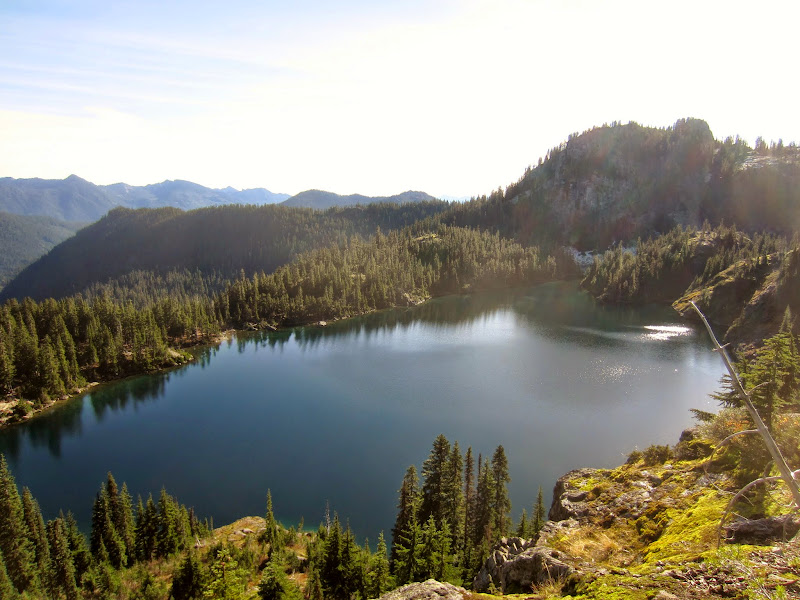
Looking down on Rachel Lake as we made our way up the ridge
It had taken us just over 2 hours to reach the lake, a little longer than I expected. I wanted to eat a bunch as I still wasn't feeling great. Sunset was around 5pm and we still had another 1600' to the top, and then 6 miles down to the car. We had two headlamps among the three of us but some cellphones we figured we could use for light on the trail out if needed. Still not sure if I was quite up for the rest of the hike, we decided to take a baby step and head up the ridge, another 500' in elevation gain, and decide up there to either head up Alta Mountain or just check out the lakes. We made good time up the ridge and made the decision by 12:20 to head up Alta. My GPS said it was less than 1.5 miles away and Sara said I could turn around when I needed to, so I figured I might as well give it a try. It felt really close given the 4+ miles we had already traveled. We put Matt out front as he'd run up the trail until he got to a good view point and then stop to take pictures while he waited for me to catch up. We found all of the correct trails and finally had the top of Alta Mountain in sight! It definitely provided a renewed sense of motivation to keep hiking up.


[Left] Out of the trees and heading up the ridge to the top. [Right] Lila Lake
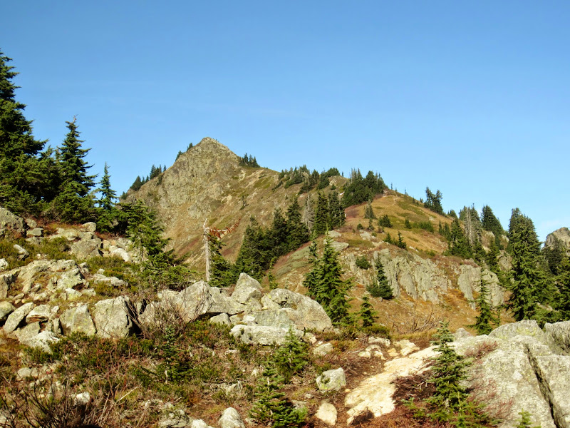
As we reached the top we realized it was a false summit. I had read one trip report that mentioned four false summits but I had hoped it was wrong - turns out it wasn't. I didn't say anything though as we would top one false summit to find another in our way. Finally we spotted the true summit with a couple of people up there - about 100' of elevation to go.
[Left] The first of four false summits. [Right] The last false summit, with the real one in the background
We summited just after 1:30p. The couple that was up there was packing up as we arrived, to head back down over Rampart Ridge, a different approach than we had taken. The views up the ridge to the top were great, and of course they only got better at the summit. Mount Rainier dominated the southern horizon and we could even see the top of Mount Adams. It was really fun to look east at the Commonwealth Basin and get a different perspective of Red Mountain and the Kendall Katwalk. We could trace the PCT trail across the mountainsides as it ran above Alaska Lake and eventually over towards Mount Daniel. We ate some more food and kept the break short as we knew we still had a few hours of descending ahead of us before we made it back to the car - hopefully before dark. We figured it'd take us about 3 - 3.5 hours down.

Summit view from the east to the south

Summit view from the west to the north

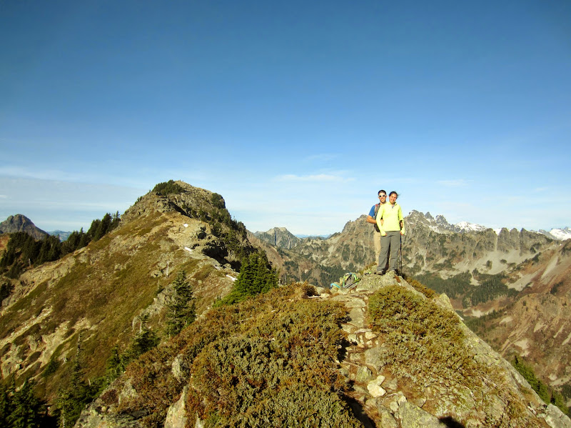
Group summit shot
Just before 2p I started down first and tried to set a brisk pace back across the false summits, and finally down to the ridge. We made good time back to Rachel Lake and we were taking a short break just under an hour from when we left the top. We encountered a lot more people on the way down, both heading down and still going up. My knees were a bit achy so Matt found a big log for us to take a short break on. We had descended close to 2800' so a break felt good. We hit the trail again and were soon on the long, relatively flat section of the trail with my knees feeling better. We made steady progress back down, navigating through the streams and mud again, and emerged back at the trailhead just before 5pm. It had taken us about 2 hours and 50 minutes down from the summit. Most importantly we made it out before needing our headlamps. We packed up our muddy boots and prepared for the bumpy ride back down the forest service road. To top off a great day, we stopped for burritos in Issaquah on the way home. The approach to Rachel Lake is a bit wet, and gets to be long, but the hike up to Alta Mountain was beautiful. I'm very glad we picked that peak to enjoy a rare, beautiful November day out in the mountains.

To get the gps track file, visit Google Maps here

Trail up Box Canyon to Rachel Lake, then we followed the ridge up to the summit of Alta Mountain

Top of the trail to Rachel Lake, and the rest of our trail to the top along the ridge, past four false summits