Saddle Rock 10.25.14
Aaron and I were in Wenatchee for the weekend checking some things out so of course I wanted to check out some of the local hikes as well. We tried to head to Horse Lake but the road was too muddy for my liking - I didn't like fish tailing on the narrow road with my wheels caked in mud. We headed back towards town and instead went to Saddle Rock. We picked out what we thought looked like a saddle on the ridge thanks to two rock formations, found a parking spot at the small trailhead, and discussed if we should head out. The trailhead was very popular with people coming and going quite often. It had just started to rain but it was light. All we had been doing was driving and eating, and we had a few hours to waste before we could check into our hotel, so I wanted to get out and hike. Aaron was not so convinced especially considering the rain.

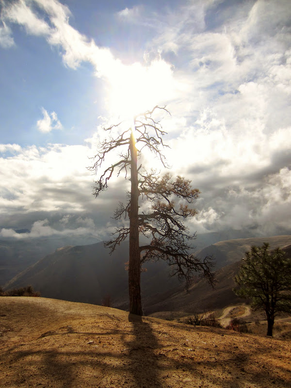
Starting the hike up to Saddle Rock
We decided to go anyways, grabbed a couple of liters of water to throw in my little flashpack and we hit the trail. The trail itself seems to be an old road that heads up the mountainside, although there is one section that is fairly steep. The water running down the trail has created some deep ruts and breaks in the dirt. There were several other trails off of the main that have been closed for rehabhilitation - we could tell it was a popular destination for the town. As we were heading up the steepest section, the rain picked up a bit. I asked Aaron if he wanted to turn around knowing how much he dislikes hiking, especially in the rain, but he deferred to me so we kept heading up. I felt like we were past the hardest part anyways, it couldn't be that much farther.


[Left] Cool looking tree and roots along the trail thanks to erosion. [Right] Looking across at the rock formations, almost to the ridge to traverse over there for some playtime
We could see our destination, the rock formations, but the trail was not very direct and instead switchbacked up the mountainside to the ridge a little ways away from the formations. The sun was just poking through the clouds as we reached the ridge and we got our first good view of Wenatchee and the Columbia River below, complete with rainbow. we traversed a short distance along the ridge to reach the northern rock formation, the one that looked easier to scramble. It took us about 35 minutes total to hike to the top, a short little jaunt over about 1.5 miles and just over 900 feet up.

[Left] View from the ridge of Wenatchee and the Columbia River, complete with rainbow. [Right] Tree along the ridge we traversed to get to the northern rock formation.
Aaron quickly made his way to the rock and assessed the very last section to the top. Under normal conditions we probably wouldn't have thought twice, but we were having a hard time getting all of the mud caked to the bottom of our shoes off so we wanted to make sure we wouldn't slip given the little bit of exposure. The rock seemed fairly ledgy with knobs so up we went without much pause and enjoyed the views from the very top. The summit is probably big enough for 2 - 4 people, not huge, but big enough.


[Left] Aaron scrambling to the top, happy to have some rock to play on. [Right] Aaron and I on the top of Saddle Rock.

View from the top of Saddle Rock over the Wenatchee Valley
On our way down we decided to check out the other rock formations as well. The small middle one had huecos like those found in Smith Rock. Aaron scrambled up to the top while I found some shiny bolts off of the other side of the northern formation - a sport route! It wasn't very long but it was fairly overhung and pretty thin with about 7 bolts protecting it, and a few draws left in place. We stopped near the south formation, a bit steeper, and decided the other ones had provided enough fun. The clouds looked like they were going to roll back in with the rain so we wanted to get back to the car before we got too wet. We cut down the hillside near the top, avoiding just the uppermost switchbacks, and then stuck to the main trail all the way down. We spent about a half hour up on the rocks and just under a half hour coming down. I'm glad we braved the weather and got to play on some rocks. The hike was fairly short with some great views out over the valley.


[Left] Aaron climbing on the middle formation, reminiscent of Smith with huecos. [Right] The bolted route on the south side of the northern rock formation.

Our trail up to Saddle Rock. Link to the GPS track can be accessed in Google Maps here