Rattlesnake Mountain East Peak 11-21-09
Since snow season has descended on the northwest mountains, I have had to rethink my hiking game plan. Some of the hikes I was trying to get in have been moved to my list of possible future hikes and my planned hikes now include those that are nearby and are at lower elevations so that there should be no snow to drive through. Following this new game plan, I decided to do some hiking at Rattlesnake Mountain, a familiar favorite of mine. My favorite quick, after work hike is to Rattlesnake Ledge on this mountain. I've done that 4 mile hike 5 times in the last year. However, the Rattlesnake Mountain trail extends well beyond this little ledge. In fact, I discovered that there is another trailhead to access the trail from the other side of the mountain. I think I will do a hike from there in the near future, but today I decided to go to what is familiar.
I didn't want to change my track record so I again got off to a later start than anticipated. The SIM card in my phone is very finicky so my alarm didn't go off this morning. I managed to leave the apartment about 9:10 AM and then made a pit-stop at the Safeway in Renton for gas and bagels. That Safeway usually has the cheapest gas I can find and the most delicious jalapeno-cheddar bagels. Good thing the rest of my planned hikes for the year are the same direction so I can get delicious bagels every time for breakfast. I made it to the parking lot at the Rattlesnake area park about 10:15 AM. There were already several cars parked there and a few more that arrived at the same time as me. Along with my new hiking plan comes more populated hiking trails. I got spoiled, often times finding seclusion on the trails leaving me with just my thoughts and nature (and usually music thanks to my little MP3 player). Since many of the hikes are becoming inaccessible, those few that are accessible are going to be busy so I just have to change my mindset and expectations. It was raining pretty well when I arrived so I got my rain gear ready - pack cover on, rain pants on, and my shell. I left the trekking poles in my car since they don't strap onto my pack very well with the cover on. I put my camera in the waterproof case and set out for the trail.
The last time I had hiked to the Ledge it took me 2 hours up and back, so I was pushing myself a little on the way up. This was the first time hiking on this trail with my GPS so I was kind of excited to see the track map I would create. There was another group of WTA volunteers doing trail maintenance today. They were gone by time I came back down the mountain though. I was surprised how green everything still was. Moss everywhere and everything was just slightly damp, it was kind of a nice sight considering I'm entering winter mode already. It was suppose to be chilly so I layered up but found I was overheating, so I stopped for a quick break at the little lookout over Rattlesnake Lake, at about 1 mile in. I took off one of my long sleeve shirts and stowed my knit hat. I set off back onto the trail, heading for my beloved Ledge. I got to the Ledge and of course had to take a few pictures. It was a cloudy day but still nothing compared to my first hike to the Ledge with Justin, that was a little ridiculous. I am a sucker for snow and was happy to see the snowline on the nearby mountains. My first encounter with a snowline was on my hike to the Hidden Lake Lookout last October. As I was hiking today I was thinking about that and realized why it seemed so cool to me...there is no elevation in the Midwest so if there is snow, it's on the ground all around you, there's no magical distinct line dictating what gets snow and what doesn't. I knew there was some wet stuff coming down on me while I was at the ledge, but I assumed it was the rain from before still. Much to my delight, I finally noticed big wet snowflakes were to blame, yay snow!
After taking a few pictures I was excited to embark on the trail since everything forward from that point would be new to me. It was fun combining a very familiar hike with an element of newness and surprise. I decided to really enjoy the rest of my hike in this new, unexplored (by me) territory. I found a couple of side trails to more ledges so I took a few pictures. It was interesting to be looking down at Rattlesnake Ledge, to have that perspective. I continued on the trail through the trees. It was still fairly green a little bit above the Ledge, but the trail was much more narrow. You could tell it doesn't get nearly the same use as the trail to the Ledge does. There were also fewer people on that section of the trail. Soon I crossed that snow line and entered a winter wonderland. There was only about half an inch for a mile or so, but then I entered the deep stuff. It was so pretty, and you know how much I love snow, so I of course took lots of pictures of the white stuff. The trail seemed to cross a few roads so there were the big wooden hiking gates, the ones that are meant to keep everything else off the trail except for hikers.
I was checking my GPS, noticing I had gained another 1000' in elevation but it looked like I still had a mile to go. I know from experience that my GPS seems to short me on the distance my trip odometer shows, so I was hopping that I only had a half mile left. Much to my surprise, I didn't even have that much distance. I emerged from the trees into this large clearing, took a few pictures, and soon found myself at the peak. There was another mileage sign showing how far away Rattlesnake Lake, Grand Prospect, and Snoqualmie Point were. There were a couple of benches but both were occupied. I walked towards this large tower and took a couple of pictures before deciding to plop down in the snow for some lunch. I had my rain pants on so I figured I wouldn't get wet, probably just a little cold from sitting in the snow. I treated myself to a fabulous PB&J while the snow fall increased, took a few more pictures, and decided to head back to the car. There was a little bird at the top that was cute, and he looked almost furry. I'm guessing something changes with their feathers for the colder weather.
The hike back down was a breeze and I was lost in my own thoughts as I walked through the snow and trees. Soon I found myself back in the wet forest with no more snow. I passed by the Ledge again and picked up the pace on the way down. I finished almost 9 miles in just under 4.5 hours, about my typical pace. It is interesting to think I had finished 8 miles in 3 hours the weekend before, but that's probably why my legs were so sore too. It was a great hike and I really enjoyed my winter escape at the top of the mountain. I definitely would like to hike to Grand Prospect, probably from the other trailhead. Maybe some day I'll do the whole trail, if I can talk a friend into going with me so we can leave a car at each trailhead.


View Rattlesnake Mountain East Peak 11-21-09 in a larger map
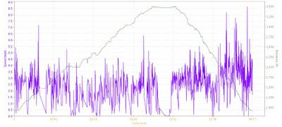
Stats
Way points are recorded on the Google map.
- Total Time: 4:17:48 (h:m:s)
- Time Breakdown: 37.1% Ascent, 30.5% Descent, 6.1% Flat, 26.3% Stopped (25 stops)
- Distance: 8.8 mi
- Distance Breakdown: 46.5% Ascent, 44.3% Descent, 9.1% Flat
- Moving Speed Average: 2.8 mph
- Average Speed Breakdown: 2.5 mph Ascent, 2.9 mph Descent, 2.8 mph Flat
- Maximum Speed: 8.6 mph
- Maximum Speed Breakdown: 7.3 mph Ascent, 8.6 mph Descent, 6.3 mph Flat
- Elevation Gain: 2,700 ft
- Vertical Speed Average: 20.2 ft/min Ascent, 20.2 ft/min Descent
- Vertical Speed Maximum: 161.3 ft/min Ascent, 374.7 ft/min Descent
- Grade Average: 17.1% Ascent, 17.9% Descent
- Grade Maximum: 51.2% Ascent, 77.0% Descent
- Temperature Average: 44.6 deg F
- Wind Speed Average: ESE 3.5 mph